ENE - ESE |
Wrynose Pass |
| Status : | OK | ||
| IMPORTANT - Restrictions on use | . To clarify, we were once asked to call in to the farm, this is now not required and this situation can remain this way if we fly responsibly avoiding stock. The landing areas have been amended, taking out the old field landing options, which in turn has allowed us to fully open this site. Please respect the request for No dogs! The farmer has asked us to keep well clear of hay and silage fields. This shouldn't be a problem as most flights end above the intake wall. A bird of prey nests near the site (buzzard?). Several wings have been damaged (2020 & 2023). Strong likelihood of attack if you hang round near the site, especially in the nesting season (Apr, May, Jun). . |
||
| Last Updated : | 04/06/2023 at 15:42 by Rick Livingstone | ||
| Wind : | ENE - ESE | ||
| Nil Wind : | No | ||
| Grid Ref : | NY279030 | Height (AMSL) : | 1600' / 488m |
| Site Code : | 17.084 | Top to Bottom : | 1100' - 700' / 336m - 214m |
Location
Central Lakes - W of Ambleside
Details
A stunningly spectacular site with the bonus of a road to the top (a short walk up may be necessary in lighter winds). Can be turbulent in strong winds if not a due easterly. A good site to begin exploring the Coniston and Langdale fells.
Site Officer
John Westall : 07884 037144
Postcode for Sat Nav Systems (read the Health Warning!)
LA22 9PE - This is the closest mail delivery point to the flying site and is positioned at:
Fell Foot Farm.
Getting There
Approach from the south west via the Dunnerdale valley or from the east via Little Langdale.
Getting to takeoff
Take off can be just in front of the parking area or via a short walk 200' / 80m higher on the ridge to the north.
Permission to use site
Fell Foot Farm.
Additional Safety Notes
The site becomes increasingly turbulent if wind goes more than 20 degrees off the hill. Beware of this as it has caught pilots out and has resulted in accidents. Also be vigilent for the sea-breeze that will come in over the back!
Paragliding
Beware penetration problems over the higher peaks. Land at the bottom of the bowl 700'/ 225m below T.O. or by the side of the road leading up to pass ( below Hollins Slack).
Hang Gliding
In light winds it is usual to carry to the higher take-off.
XC potential
Limited to the west but good potential to use as a starting point to explore the Coniston or Langdale fells when conditions allow.
Photos
Click on the photo for a full size image.
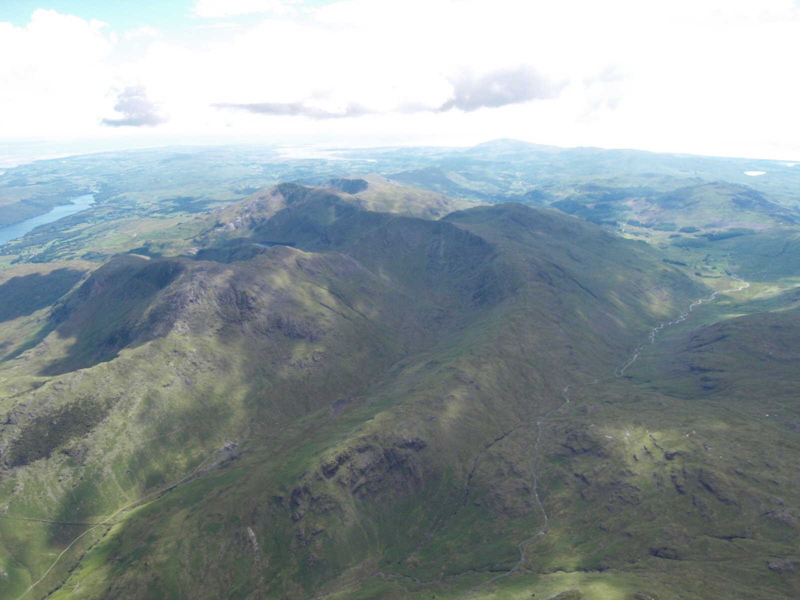
| A general view of the Wrynose Pass area. The road over the pass can be seen clearly on the right hand site with the summit about a quarter of a way up the picture. Coniston Water can be seen in the top left and the Old Man of Coniston is above Levers Water. The Wrynose Pass road leads down into Little Langdale. |
 |
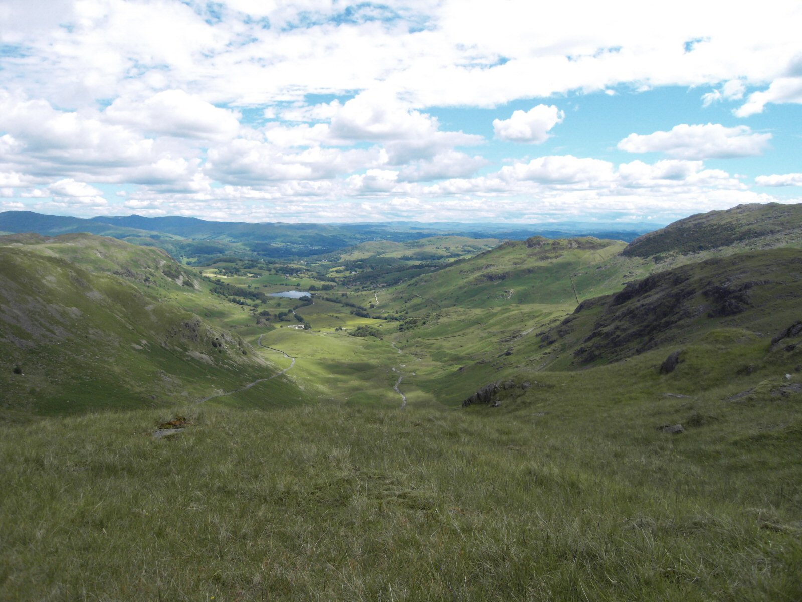
| Looking down from take off into Little Langdale with Litte Langdale tran visible. Fell Foot Farm can be seen between the tran and take off. You can see why the site works best in a easterly direction only. |
 |
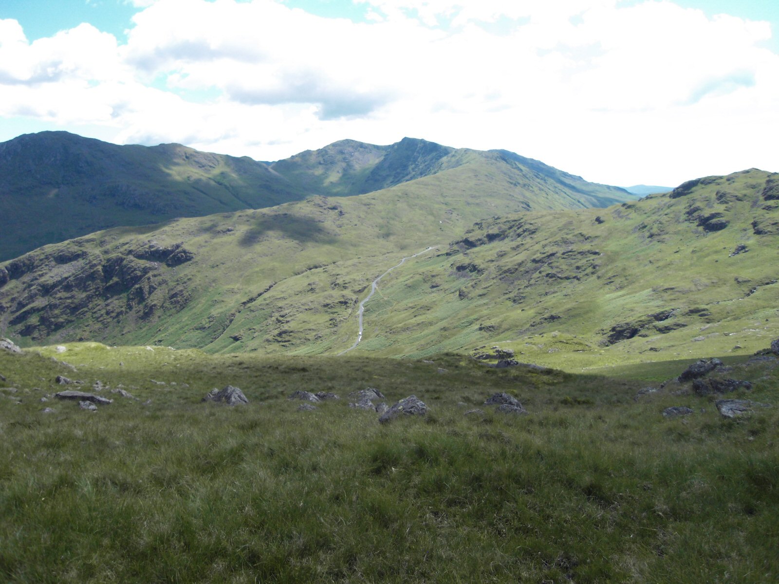
| From Little Horse Crags looking over to the summit of Wrynose Pass. Swirl Howe is in the background. |
 |
Local Information - Pubs/Food etc
Nearest pubs to the site - for post flying debriefing only! You may find details of other facilities here
No pub details are available for this site. Send your recommendations to the webmaster.
This page shows records for this site. Some of the older records are not very detailed. More recent records may have an igc file available You can right click and download this to your PC. You can then use IGC Flight replay to view the flight.
| Paragliding |
| FAI Triangle | |
| Distance : | 50.9km |
| Date : | 27/04/2011 |
| Pilot : | Mike Cavanagh |
| Notes : | Record triangles also set this day from Catbells, Blease and the biggest of the day by Chris Scammell from Scales Fell 75.5km This is also the biggest triangle flow by a PG within the Lake District |
| IGC File : | Right click to download |
| Turnpoint Flight | |
| Distance : | 47.6km |
| Date : | 15/05/2008 |
| Pilot : | Burkitt Rudd |
| Notes : | |
| IGC File : | Right click to download |
| Hang Gliding |
| FAI Triangle | |
| Distance : | 50.9km |
| Date : | 27/04/2011 |
| Pilot : | Mike Cavanagh |
| Notes : | Record triangles also set this day from Catbells, Blease and the biggest of the day by Chris Scammell from Scales Fell 75.5km This is also the biggest triangle flow by a PG within the Lake District |
| IGC File : | Right click to download |
| Turnpoint Flight | |
| Distance : | 47.6km |
| Date : | 15/05/2008 |
| Pilot : | Burkitt Rudd |
| Notes : | |
| IGC File : | Right click to download |
Data Resources
Follow the links to see the site in Google Earth and Google Street view. To access the former, you will need to have Google Earth installed on your PC. You can also upload your flights to GE - use GPS Dump (Links Page) to convert a variety of GPS file formats to a GE kml file.
| Link | Resource Type | Notes |
|---|---|---|
| Google Earth - Car Park | ||
| Google Earth - Take Off | Birkitt Rudd - 15 May 2008 | |
| Google Street View - Parking | The 3 shires stone (westmorland, Cumberland, Lancashire) at the Wrynose Pass |
Wrynose Pass Map |
Legend |