
Site Map Legend
All maps are based upon the Ordnance Survey 1:25,000 maps. Check the scale on the map as a couple of the maps are a smaller scale than the rest - Brigsteer being an example.
A full list of 1:25,000 map symbols can be found here. The main Ordnance Survey site is here
A number of symbols have been added to the maps.
| Symbol | Meaning |
|---|---|
 |
Power line - usually the very high voltage type. Minor power lines are generally not shown. |
 |
Take off point. Take off points are purely indicative and are not precisely placed. Pilots should use their judgement on the day to decide the best take off point in relation to the conditions. In the site data section, a Google Earth take off is a point where at least one pilot has taken off as validated by a tracklog point. |
 |
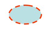
Landing area. Always read the site notes for observations on landing areas as all areas might not be available at all times |
 |
Parking area. Space is usually at a premium on busy days |
 |
Major road |
 |
Key feature on the site |
 |
Walking route to take off (suggested) |
 |
Restricted area. Read site notes for observations. This may be a no fly area or a no landing area. |
 |
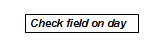
Special restrictions apply to this site. Read the site notes. |