W - WNW |
Ullock Pike |
| Status : | OK | ||
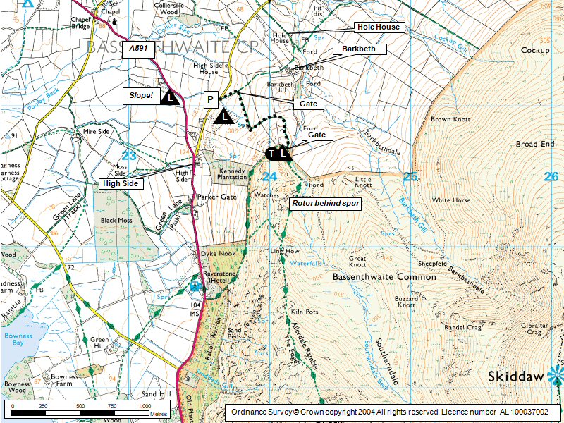
| IMPORTANT - Restrictions on use | This is a sensitive site, please follow the restrictions carefully: - Do not overfly the fields directly SSW of the Ravenstone Hotel at less than 1000ft ASL. If you see any horses being spooked by your presence fly away immediately. - Do not land in fields on the lake side of A591 without permission. Check at High Side Farm before flying if you wish to use the bottom landing field shown on site guide map. - Nornally choose a bottom landing area east of the A591, on the low fell, away from stock, preferably in the area shown on the site guide map. |
||
| Last Updated : | 10/08/2022 at 16:02 by Rick Livingstone | ||
| Wind : | W - WNW | ||
| Nil Wind : | No | ||
| Grid Ref : | NY240304 | Height (AMSL) : | 1000' / 305m |
| Site Code : | 17.077 | Top to Bottom : | 550' / 168m |
Location
N Lakes - W of Skiddaw
Details
A stunning site only marred by very tricky top landing. From Ullock the whole Skiddaw area can be explored.
Site Officer
Rick Livingstone : 07761187016
Postcode for Sat Nav Systems (read the Health Warning!)
CA12 4QY - This is the closest mail delivery point to the flying site and is positioned at:
About 500m NNE of the parking area. The point is near the 164m spot height is on a 1:50000 map. If you're coming from south and west, stop before you reach this point.
Getting There
Take the A591 from Keswick heading north along the side of Bassenthwaite Lake. At High Side bear right up a minor road and after 300m there is a pull in place with limited parking.
Getting to takeoff
Use the footpath that goes round the north spur of the ridge and approaches the take off area from the back. DO NOT go directly up the field to the wooden stile.
Permission to use site
High Side (located at the junction with main road), Barkbeth and Hole House
Hazards
This is a classic spine back ridge
Dangerous and severe rotor behind the ridge
If wind goes off to the south it can become violently rough.
If dropping back onto Skiddaw have at least 600' ato. (185m)
Rotor behind Dodd.
Electric wires at bottom of landing field.
Take Off
Can take off area from the first knoll or the shoulder.
Landing Areas
See restrictions
If winds are light there are a few high level landing options, but beware being blown back into rotor!
Nornally choose a bottom landing area east of the A591, on the low fell, away from stock, preferably in the area shown on the site guide map.
Best bottom landing for PGs is above the car park - but fields do slope away from the hill.
Electric wires at bottom of landing field.
Flying
Excellent in light to moderate winds but beware of penetration problems in stronger winds.
XC potential
Good XC's have been done from here but not always an easy place to get away from.
Photos
Click on the photo for a full size image.
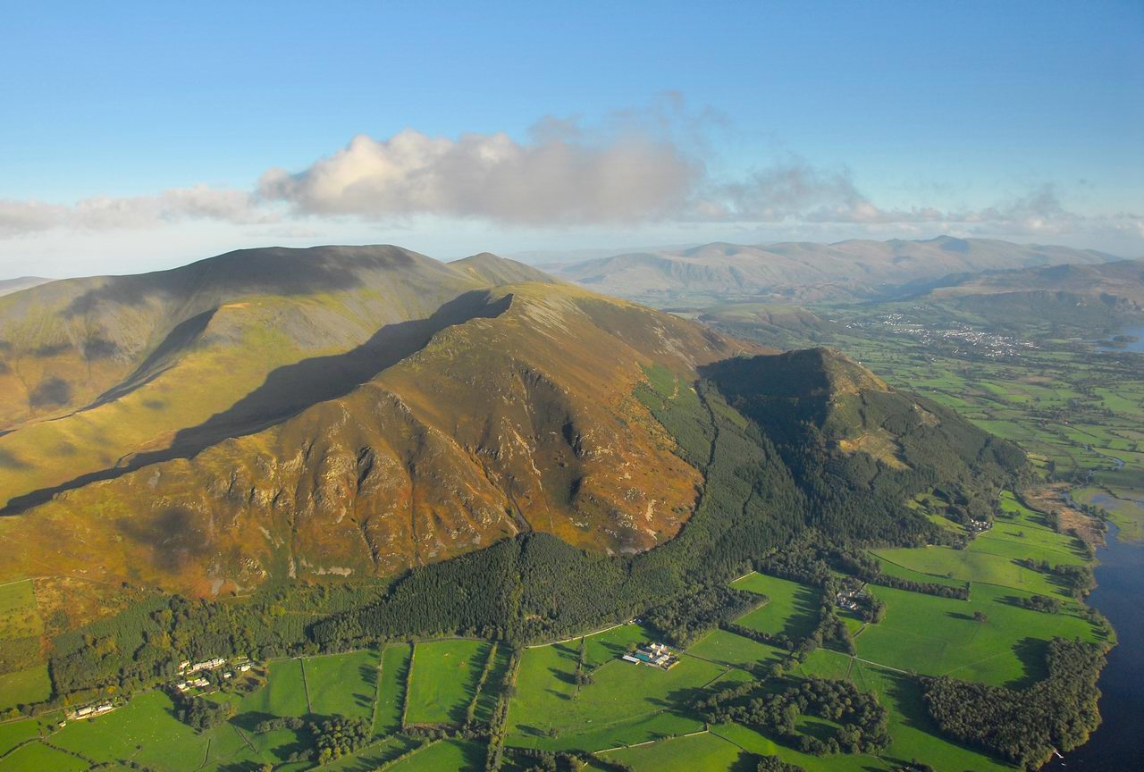
| An aerial view of the Ullock Pike ridge and Skiddaw behind looking SE. Ullock Pike is the first ridge in the picture. Take off is the paler area almost directly up the hill from the block of the right hand group white houses on the left hand side. Photo reproduced with the permission of the copyright owner, Andrew McMahon. More pictures can be found on his web site. |
 |
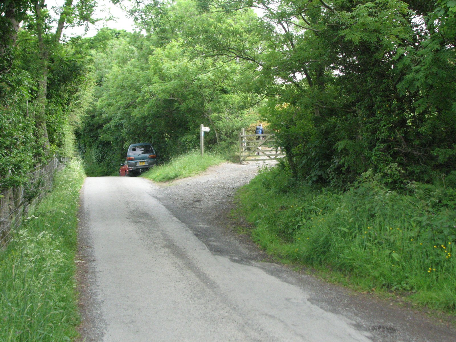
| The start of the footpath up Ullock Pike. The landing field is immediately after the gate. |
 |
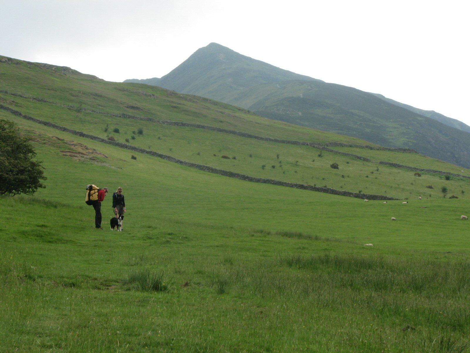
| The view from the landing field up to Ullock Pike. You will be pleased to know that take off is at the small col after the heather covered hill, before the main peak in the background. |
 |
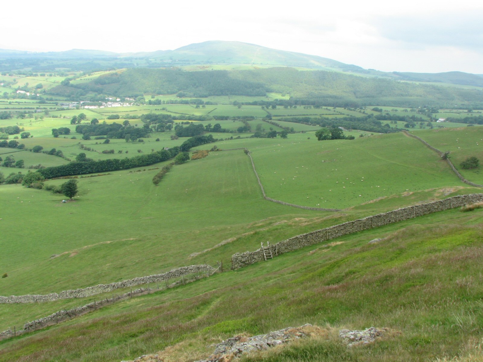
| Looking down on the landing field from above the fell wall. The landing field is to the left of the wall running away in the middle of the picture. The field does slope. |
 |
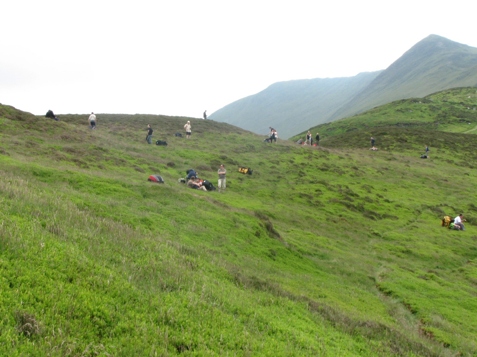
| The take off col which is extensively covered in heather and bilberry. There are some clear areas of grass but small in nature. |
 |
Local Information - Pubs/Food etc
Nearest pubs to the site - for post flying debriefing only! You may find details of other facilities here
No pub details are available for this site. Send your recommendations to the webmaster.
This page shows records for this site. Some of the older records are not very detailed. More recent records may have an igc file available You can right click and download this to your PC. You can then use IGC Flight replay to view the flight.
| Paragliding |
| Open Distance XC | |
| Distance : | 87.7km |
| Date : | 13/04/2018 |
| Pilot : | Brian Doub |
| Notes : | A XC flight from Ullock Pike via Tebay to north of Redmire in Wensleydale. Brian says "The XC potential from Ullock is very good once you cross the Keswick valley to the Helvellyn range. From there you have already added 10 km onto the Clough to Grasmere/Ambleside run and the potential to go over the back onto the Howgills and beyond is great, especially if you can connect with the sea breeze convergence coming up from the South." |
| IGC File : | Right click to download |
| Out and Return | |
| Distance : | 38.9km |
| Date : | 07/08/2014 |
| Pilot : | Steve Etherington |
| Notes : | A very interesting flight down to Helvellyn and back. Glider Nova Mentor 3 |
| IGC File : | Right click to download |
| Hang Gliding |
| Open Distance XC | |
| Distance : | 87.7km |
| Date : | 13/04/2018 |
| Pilot : | Brian Doub |
| Notes : | A XC flight from Ullock Pike via Tebay to north of Redmire in Wensleydale. Brian says "The XC potential from Ullock is very good once you cross the Keswick valley to the Helvellyn range. From there you have already added 10 km onto the Clough to Grasmere/Ambleside run and the potential to go over the back onto the Howgills and beyond is great, especially if you can connect with the sea breeze convergence coming up from the South." |
| IGC File : | Right click to download |
| Out and Return | |
| Distance : | 38.9km |
| Date : | 07/08/2014 |
| Pilot : | Steve Etherington |
| Notes : | A very interesting flight down to Helvellyn and back. Glider Nova Mentor 3 |
| IGC File : | Right click to download |
Data Resources
Follow the links to see the site in Google Earth and Google Street view. To access the former, you will need to have Google Earth installed on your PC. You can also upload your flights to GE - use GPS Dump (Links Page) to convert a variety of GPS file formats to a GE kml file.
| Link | Resource Type | Notes |
|---|---|---|
| Google Earth - Car Park | ||
| Google Earth - Take Off | ||
| Google Street View - Parking | The parking area at Ullock Pike |
Ullock Pike Map |
Legend |