SE - ESE |
Souther Fell |
| Status : | OK | ||
| IMPORTANT - Restrictions on use | SITE SENSITIVITY: This site is EXTREMELY SENSITIVE and subject to these rules: 1. Max 10 in the air at any time - the new farmer will be checking this and the site could be lost if the numbers limit is exceeded. 2. - The CSC strongly recommends the use of a radio on this site (club frequency 143.700). This will enable communication between pilots flying and those on the ground waiting - please share airtime around. 3. Schools and students are requested to give qualified pilots priority. 4. IMPORTANT - Landing fields and procedures have changed, see 'Landing Areas' in 'Flying' section for details. 5. Visiting pilots have caused problems here by ignoring the site guide. Further infringements may result in site closure to non CSC pilots. 6. Note that it has taken a lot of work to get this site back - it was very nearly lost for good. EXCLUSION ZONE: DO NOT LAND in any areas heading towards Carrock Fell - THIS WILL POTENTIALLY LOSE US THIS SITE, A PERMANENT EXCLUSION ZONE EXISTS AROUND UNDERCRAG FARM DO NOT FLY IN THIS AREA (500M RADIUS AND 1500FT ASL @ NY 363308). LAMBING: CLOSED FOR LAMBING for the whole of APRIL & MAY. Contact North Sites Officer if uncertain (077611 87016). |
||
| Last Updated : | 01/06/2024 at 22:18 by Rick Livingstone | ||
| Last Reviewed : | 01/04/2022 by | ||
| Wind : | SE - ESE | ||
| Nil Wind : | No | ||
| Grid Ref : | NY355291 | Height (AMSL) : | 1700' / 519m |
| Site Code : | 17.015 | Top to Bottom : | 950' / 290m |
Location
NE Lakes - SE of Blencathra
Details
An excellent site, renowned, like its neighbour Carrock, for light winds. Also thermals well. Wave and convergence are occasionally found at the south end. It is also possible to launch from the south end to fly Blencathra in SSE winds.
Site Officer
Rick Livingstone : 07761187016
Postcode for Sat Nav Systems (read the Health Warning!)
CA11 0XR - This is the closest mail delivery point to the flying site and is positioned at:
Mungrisdale. The postcode centre is where the road coming north from the A66 suddenly turns to the west before you turn left for the Mill Inn and site parking
Getting There
Turn off the A66(T)Penrith to Keswick main road following signs to Mungrisedale. Follow minor road to Mungrisedale, then double back to follow a tarmac road (past a good pub) through a gate. Various, but limited, parking places in laybys along this road.Do not block any farm or field access points.
Although it looks a bit of a drag to walk back from Landing field (L2) to cars, it's really not far as there is a footpath and bridge over the river just north of Low Beckside Farm, bringing you out near the first gate.
Getting to takeoff
A path leads diagonally across the face of the slope from NE to SW.
Permission to use site
Low Beckside Farm, Mungrisedale.
Caldbeck Commoners Association.
Hazards
Be wary of penetration problems in strong winds, being blown back could be worrying in the extreme!
Power lines along the eastern end of the landing field.
Being blown back at Souther would be very dangerous. If you are concerned about windstrength, it is not much hardship to leave your kit at normal take-off and walk to the top to to check.
There is a farmer nearby who is not keen on flying activity. If confronted please remain polite and walk away.
To avoid aggravating the situation, some local have started to park before the village of Mungrisedale and walk up from there. (this is also easier for access from the landing field)
Take Off
Landing Areas
USE FIELD L2 (as on map), ONLY OR OTHER OPTION IS TO LAND ON THE FELLSIDE.
Note that permission from Low Beckside Farm IS ONLY REQUIRED if there is stock in the L2 field.
If L2 cannot be used due to stock, and Low Beckside cannot provide an alternative, then land on the fellside or do not fly.
Although it looks a bit of a drag to walk back from Landing field (L2) to cars, it's really not far as there is a footpath and bridge over the river just north of Low Beckside Farm, bringing you out near the first gate.
NB
1. The old (near fellside) landing field is now CLOSED after a serious landslide and re fenced. Please do not use this field. To get back to the road, you would need to climb over fences, which is obviously NOT Acceptable.
2. The old windsock scheme is now redundant, only call at the farm if there is stock in the L2 field and you need an alternative.)
Flying
Easy top landing and slope landing, if bracken areas are avoided.
XC potential
Good thermal producer, and quite easy to get away, but the sea is only about 35 km downwind. Possible to cross to Carrock Fell if wind is off to the East, or onto Blencathra if off to South.
Photos
Click on the photo for a full size image.
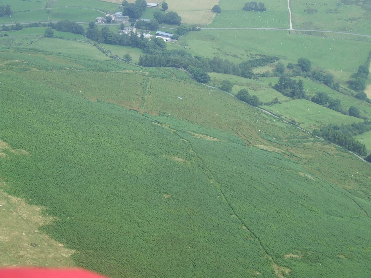
| A view of Souther Fell from the south end of the ridge looking NE. The track up through the bracken can be seen. Photo by Mike Harper |
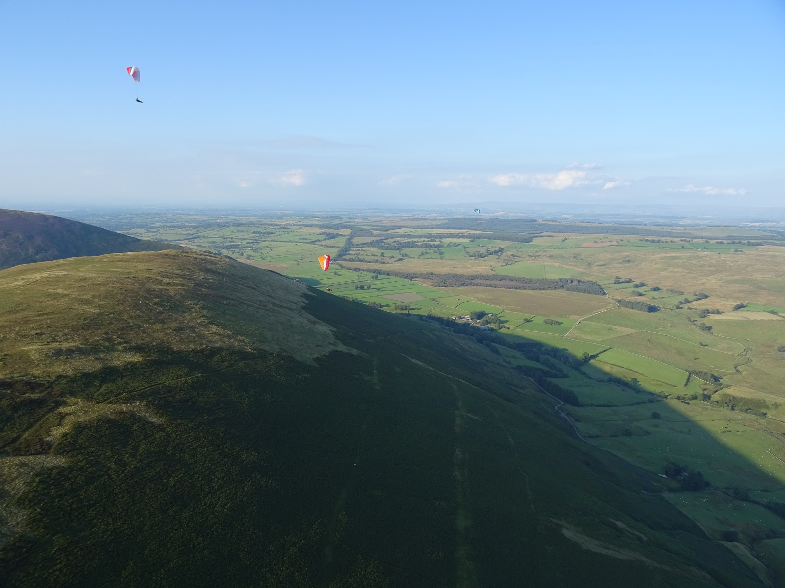 |
| General view of the ridge from the South West end, looking North East towards Mungrisdale. Launch is typically from just above the bracken line, to the right of the red wing - or much lower down on a good day if you can avoid the bracken! Photo by Dave Horne. |
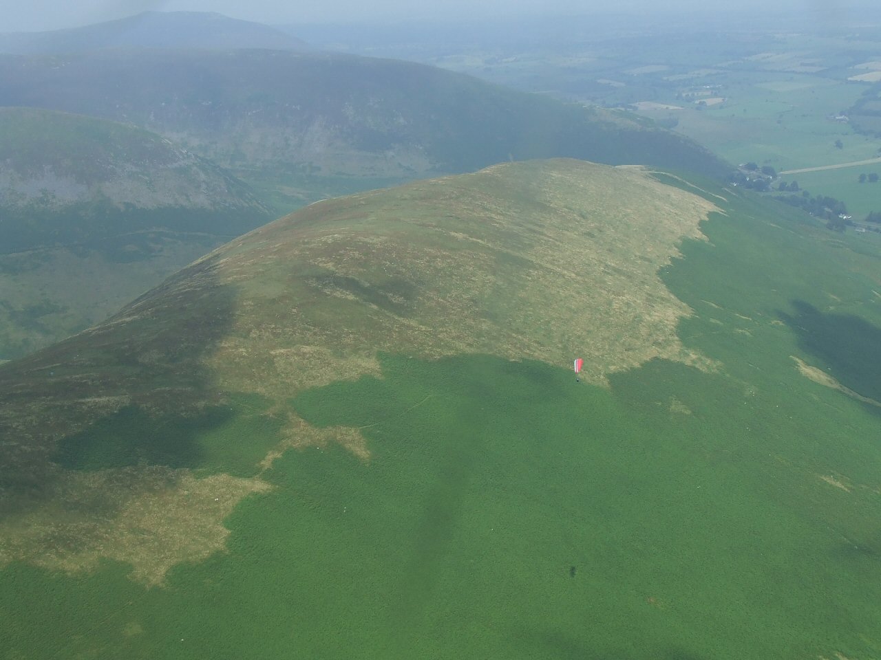 |
| Looking to the South west and down onto the Souther Fell ridge. View of the launch location above the bracken, with two gliders still on the ground - Ken West (CSC) and Andrew Maltby (NHPC). Photo by Dave Horne. |
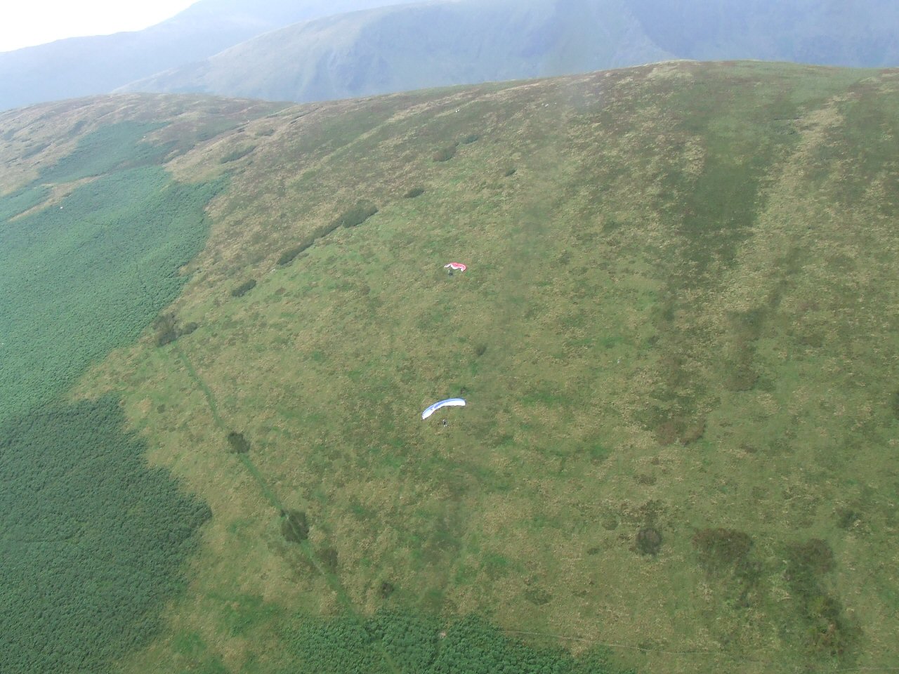 |
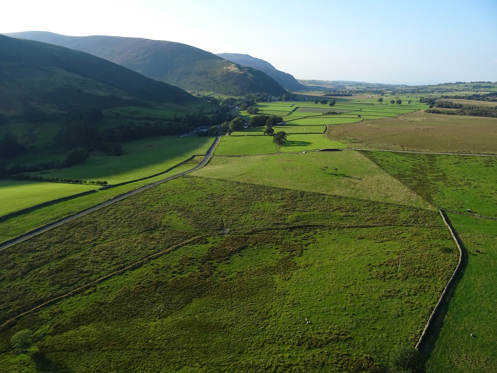
| Aerial shot of the side landing area - very tricky if there's any lift about! Landing is above the road and you do pretty well if you land on one of the more grassy areas in the roughly triangular section (the area with the glider in it). Otherwise you have to indulge in a fair bit of gardening - depending on the season - to remove bracken from the lines and wing. Photo by Dave Horne. |
 |
| Looking down on the L2 landing field (see site map). The field is centre right with a tractor on the road in the left hand corner. Photo by Mike Harper |
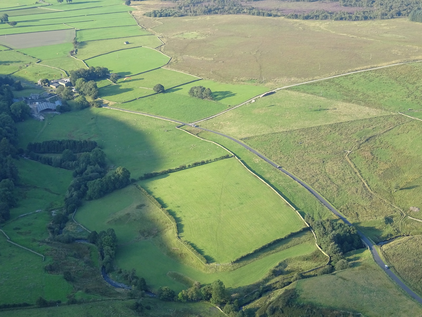 |
| A closer in view of the L2 landing field. Photo by Mike Harper |
 |
Local Information - Pubs/Food etc
Nearest pubs to the site - for post flying debriefing only! You may find details of other facilities here
No pub details are available for this site. Send your recommendations to the webmaster.
This page shows records for this site. Some of the older records are not very detailed. More recent records may have an igc file available You can right click and download this to your PC. You can then use IGC Flight replay to view the flight.
| Paragliding |
| FAI Triangle | |
| Distance : | 29.2km |
| Date : | 29/04/1998 |
| Pilot : | William Carradus |
| Open Distance XC | |
| Distance : | 60.0km approx |
| Date : | Unknown |
| Pilot : | Hugh Miller |
| Notes : | Landing near Moffat, Southern Uplands, Scotland |
| Hang Gliding |
| FAI Triangle | |
| Distance : | 29.2km |
| Date : | 29/04/1998 |
| Pilot : | William Carradus |
| Open Distance XC | |
| Distance : | 60.0km approx |
| Date : | Unknown |
| Pilot : | Hugh Miller |
| Notes : | Landing near Moffat, Southern Uplands, Scotland |
Data Resources
Follow the links to see the site in Google Earth and Google Street view. To access the former, you will need to have Google Earth installed on your PC. You can also upload your flights to GE - use GPS Dump (Links Page) to convert a variety of GPS file formats to a GE kml file.
| Link | Resource Type | Notes |
|---|---|---|
| Google Earth - Car Park | ||
| Google Earth - Landing | ||
| Google Earth - Take Off | ||
| Google Street View - Parking | The Google car driver obviously hadn't come across gated roads before. You can go through the gate and there are some limited parking spaces on the left. Make sure that you leave room for tractors |
Souther Fell Map |
Legend |