WSW - NW |
Farleton Knott |
| Status : | OK | ||
| IMPORTANT - Restrictions on use | NO TRAINING. Park out of sight as this area is an SSSI . Close all gates and do not block the track.No dogs onto the site or fellsides. ( The "driveable" track has not seen much use in recent years and it is likely that it is longer possible to top drive this site). | ||
| Last Updated : | 07/02/2021 at 04:48 by John Westall | ||
| Wind : | WSW - NW | ||
| Nil Wind : | No | ||
| Grid Ref : | SD538804 | Height (AMSL) : | 820' / 250m |
| Site Code : | 17.013 | Top to Bottom : | 600' / 183m |
Location
South of Kendal - M6 J36
Details
A popular site with all grades of pilot with easy top landing areas and a relatively large bottom landing area. The site has an extensive west face and a shorter but often thermic NNW face. The CSC "Windsock" system operates at this site; the windsock being held at Farleton House Farm.
Recent activity with pilots flying speed wings, have raised concerns about stock disturbance and upsetting our agreement with the farmer of the bottom landing field. I would like to remind all that it is good practice to pay a courtesy visit particularly if it is known that it is unlikely to make the agreed landing field. We rely heavily on the goodwill of farmers and it would be a real pity if the inaction of a few spoil it for the rest.
Site Officer
John Westall : 07884 037144
Postcode for Sat Nav Systems (read the Health Warning!)
LA6 1PB - This is the closest mail delivery point to the flying site and is positioned at:
Limefield Cottages. These cottages are on the road through Farleton village to the east of the A6070. The postcode centre is about 500m north of the normal parking area (which is on the main road)
Getting There
The normal parking area is on the A6070 on the bank on the west side of the road near the landing field. Better parking options are on the minor Milnthorpe road, 0.2 mile north of the landing field. Go over the canal bridge where there is plenty of parking space.
An alternative, eastern parking area can be used. From the A6070 at the Milnthorpe side road follow a minor road east through Farleton village to a narrow road bearing right. This leads to a gate onto the open fell. It is possible to park here. It used to be possible for brave HG pilots to drive up a track to the top of the hill if it was dry. This track is now severely overgrown and impassable for vehicles.
Getting to takeoff
From the west side. From the crossroads walk directly east on the Farleton road until it bends sharply to the left. Follow the path past the side of the white house and follow the south side of a fence going east up the hill. On the edge of small wood turn left and over a dilapidated stile. DO NOT ascend the front scree covered face of the hill as erosion is a local concern A saner choice is to follow the path that bears NE alongside the hedge. This steadily gains height until it turns to the east and fights its way through gorse bushes. Once you emerge out of the gorse turn turn South or SSE and find your way to the top of the hill on ill defined paths.
From eastern car park, follow the track for 230m then up the hillside bearing slightly right. Several footpaths exist.
Permission to use site
Dallam Tower Estates for access to the hill top. Bottom landing field: Farleton House Farm, Farleton. Please obtain the CSC windsock for the bottom landing field from here. (CHECK which field is to be designated as a landing field - during MAY/JULY the 'normal' landing field is out of bounds due to silage cutting).
Additional Safety Notes
NOTAM advised midweek. Occasional light aircraft and military jets follow the M6 using the RH rule. Beware of compression and be vigilant for any increase in wind speed that may make penetrating on a PG difficult. Public telephone in Farleton village.
Paragliding
No real vices but take care at take off and during top landings due to compression. The wind can sometimes become quite fresh over a short period of time.
Hang Gliding
As for paragliding. No known vices. Easy top landing when flying the west face, however a little more thought is required when flying the NNW face as space is limited and the slope is not as steep.
XC potential
Good, unless the sea breeze sets in which it does regularly. This often spoils, what would otherwise be, a good day.
Videos
An all round video of the take off at Farleton Knott can be found on the Vimeo web site
Photos
Click on the photo for a full size image.
| Looking up at Farleton Knott from the west, probably taken from the western side of the canal. The motorway is immediately behind. Photo by Simon Raven |
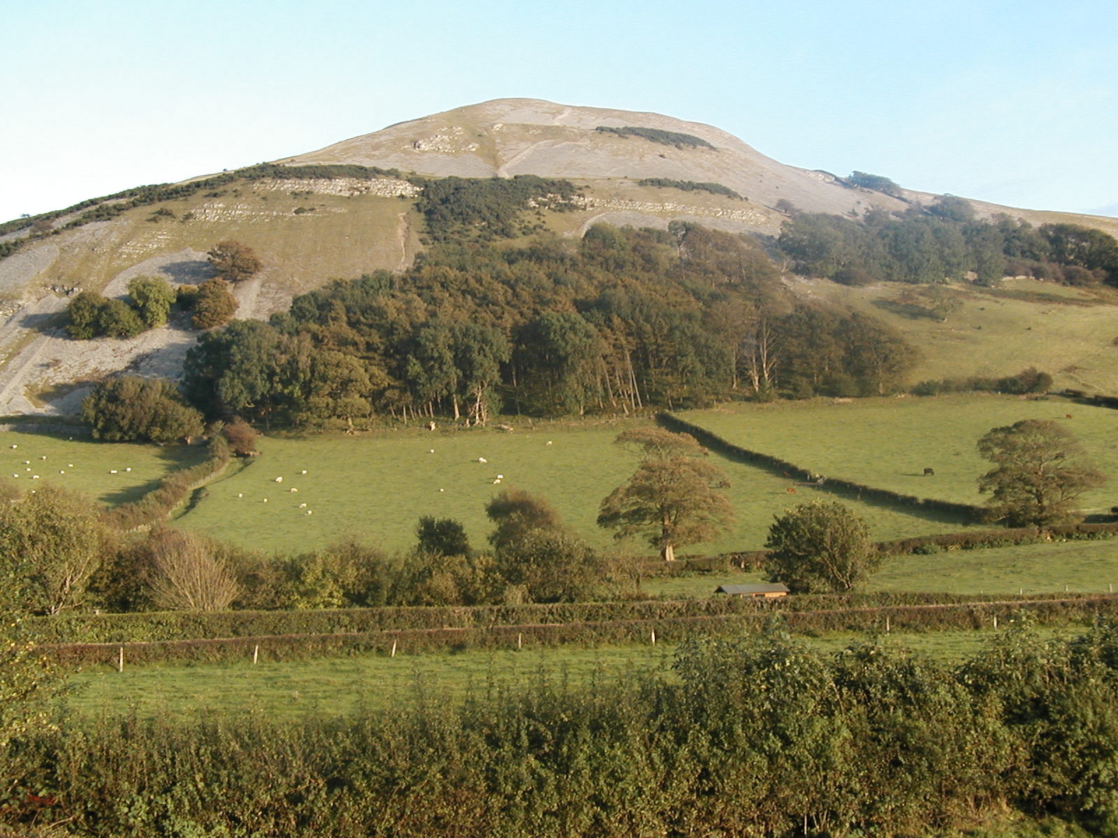 |
| A glorious evening's flying on Farleton Knott. Looking north with take off in the middle right of the picture; one of the few green bits. Photo by Simon Raven. |
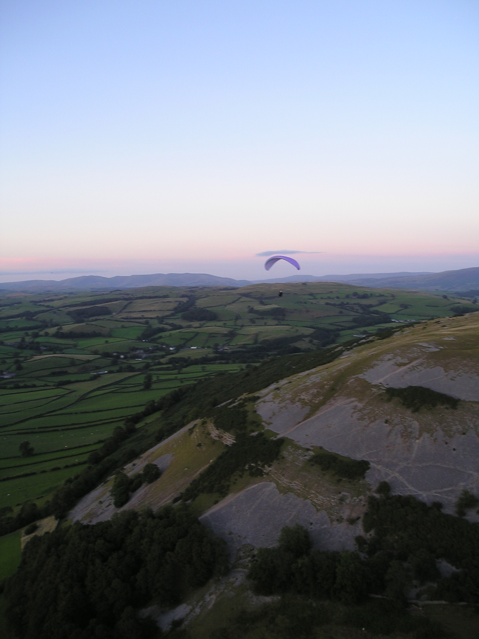 |
| A view of the north end of the hill. Photo by Dave Horne |
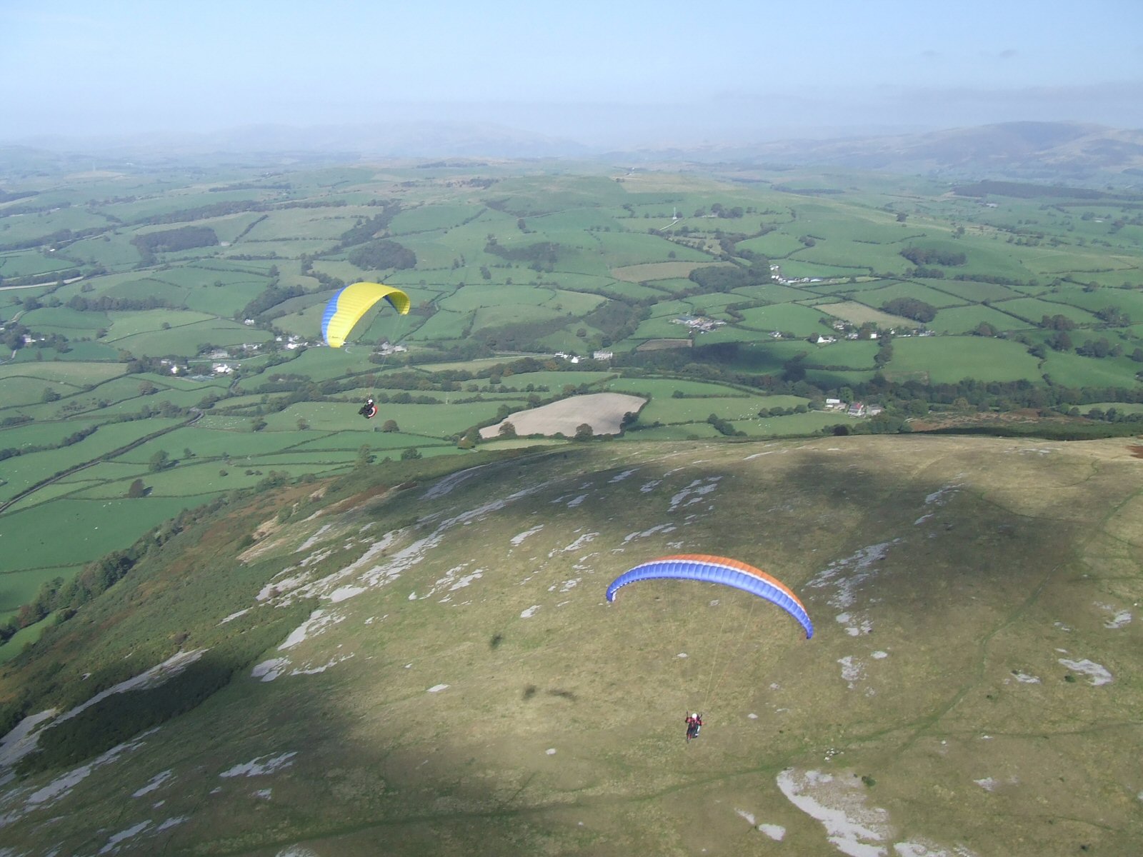 |
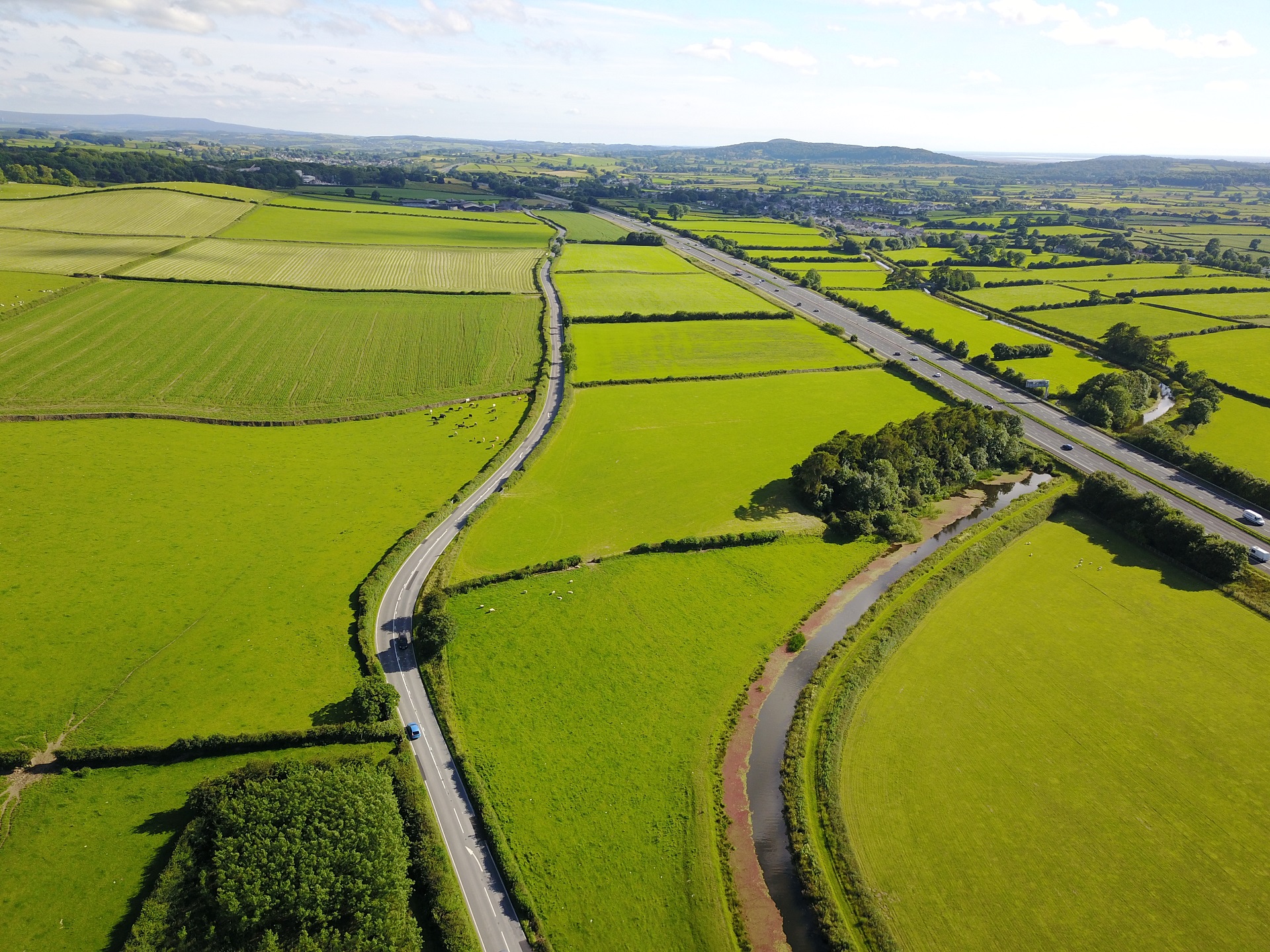
| A view of the "normal" landing field from a northern approach. The field is the one with the trees in the lower right hand corner. The field is big but note the motorway, canal and A road on the boundaries |
 |
Local Information - Pubs/Food etc
Nearest pubs to the site - for post flying debriefing only! You may find details of other facilities here
No pub details are available for this site. Send your recommendations to the webmaster.
This page shows records for this site. Some of the older records are not very detailed. More recent records may have an igc file available You can right click and download this to your PC. You can then use IGC Flight replay to view the flight.
| Paragliding |
| Open Distance XC | |
| Distance : | 61.0km |
| Max Height : | 5466ft |
| Date : | 11/04/2021 |
| Pilot : | John Westall/Keith Paterson |
| Notes : | Our objective was to try and fly to Sheffield via the small gap near Huddersfield. We were stopped agonisingly by a large Cu-nimbus perpendicular to our flight path, at a critical time in the flight (low airspace ceiling 3500' and rising ground). We were forced to land on Keighley Moor. Have a look at the flight via the Ayvri Website: https://ayvri.com/scene/mxko81gr54/cknrhx9ow00013e5fbtb8bfpx |
| Hang Gliding |
| Open Distance XC | |
| Distance : | 61.0km |
| Max Height : | 5466ft |
| Date : | 11/04/2021 |
| Pilot : | John Westall/Keith Paterson |
| Notes : | Our objective was to try and fly to Sheffield via the small gap near Huddersfield. We were stopped agonisingly by a large Cu-nimbus perpendicular to our flight path, at a critical time in the flight (low airspace ceiling 3500' and rising ground). We were forced to land on Keighley Moor. Have a look at the flight via the Ayvri Website: https://ayvri.com/scene/mxko81gr54/cknrhx9ow00013e5fbtb8bfpx |
Data Resources
Follow the links to see the site in Google Earth and Google Street view. To access the former, you will need to have Google Earth installed on your PC. You can also upload your flights to GE - use GPS Dump (Links Page) to convert a variety of GPS file formats to a GE kml file.
| Link | Resource Type | Notes |
|---|---|---|
| Google Earth - Car Park | ||
| Google Earth - Car Park 2 | ||
| Google Earth - Car Park 3 | This is the alternative parking area on the Milnthorpe side road | |
| Google Earth - Landing | ||
| Google Earth - Landing 2 | ||
| Google Earth - Take Off | ||
| Google Street View - alternative parking | The alternative parking area on the west side of Farleton Knott | |
| Google Street View - Parking | We normally park off the road on the right. You need to be completely off the road as vehicles come down the hill very quickly. A better place is 0.2 miles further north where a turn left over a canal bridge leads to a much better parking place. |
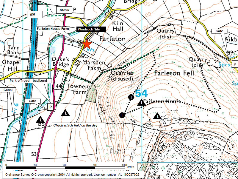
Farleton Knott Map |
Legend |