WNW - NNW |
Barton Fell |
| Status : | OK | ||
| IMPORTANT - Restrictions on use | HORSES: - STAY WELL AWAY FROM, AND DO NOT OVERFLY, ANY HORSES . WE HAVE HAD ISSUES WITH PILOTS CAUSING A DISTURBANCE TO PONY TREKKERS AND THE HORSES GRAZING IN THE PADDOCKS. THIS MUST BE AVOIDED if we are to retain this site. - We have agreed a NO FLYING AREA to the north of the ridge. SEE PHOTOGRAPH FOR BOUNDARIES. There is no minimum height or time constraints, it is a total exclusion until further notice. This annoying and regrettable situation has been forced on us. PARKING - At Roe Head. The car park is always busy and causing problems for locals. We suggest not using it, if you do ensure you do so responsibly. - At Map Ref NY 497 215 on the road verge between Helton and Scalegate. Approach the site from the East via Helton. This approach is also getting busy and issues are arising over roadside parking on the Helton road. Keep a low profile And DO NOT PLANT WIND SOCKS. See photos for more info. - If you do get involved in a dispute, be polite and report the matter to the Site Officer. LANDING: - Take care not to land in the cultivated or grazed fields below the ridge. (The ground directly between the ridge and the farm walls is fine.) |
||
| Last Updated : | 30/07/2023 at 14:23 by Rick Livingstone | ||
| Wind : | WNW - NNW | ||
| Nil Wind : | No | ||
| Grid Ref : | NY463212 | Height (AMSL) : | 1860' / 567m |
| Site Code : | none | Top to Bottom : | 890' / 271m |
Location
NE Lakes - Ullswater
Details
A brilliant site. Barton Fell is the long ridge running down the SE side of Ullswater. The site has excellent slopes with the benefit of gentle ground over the back. Lots of potential for XC flights. No formal permission yet so be polite to any farmers. Good alternative to Clough Head if you don't mind a walk.
Site Officer
Chris Field : 07514746197
Postcode for Sat Nav Systems (read the Health Warning!)
- This is the closest mail delivery point to the flying site and is positioned at:
Getting There
Approach from the East via Askham and Helton and park unobtrusively on the fell road that runs SW from Helton in area of GR 497215 (see photo)
The original approach from Pooley Bridge (Roe Head) has caused problems. If you wish to use this approach you may find somewhere to park, if you are lucky! Please be considerate and do not cause any obstruction.
Getting to takeoff
For the Helton approach there are numerous options, this is the dry one. Take the very obvious track from GR 497315 heading NW for 0.9 miles. There is a new obvious signpost at the junction (GR 487225) (see photo)where you take a less obvious track WSW and follow it to the Cockpit (0.3 miles) and then continue on a good track WSW to cross Aik Beck. Head SSW up the obvious ridge, Launch anywhere suitable along the ridge.
The original approach from Pooley Bridge (Roe Head) has caused problems with the local community. If you wish to use this approach and in the unlikely event you find somewhere to park, navigate to the Cockpit and follow directions as above.
Permission to use site
None yet, but it is common land with many users; walkers, mountain bikers and horse riders with lots of potential for conflict. Please be considerate.
Hazards
The hazards are obvious, there are no hidden traps.
Take Off
Sensible selection of a launch site eliminates any rotor issues.
Sea breeze is interesting. It can approach from either the NW or the SW. The SW SB makes launching difficult and potentially dangerous. The SW sea breeze can be observed as it approaches along the Lake which gives time to take appropriate action. The NW SB tends to reinforce the prevailing NW breeze which can be good ... or bad. If it feels too strong it is worth waiting to see if it settles. Occasionally both SBs arrive and meet in front of the launch forming an impressive convergence cloud.
Landing Areas
Take care not to land in the cultivated or grazed fields below the ridge. (The ground directly between the ridge and the farm walls is fine.)
Apart from the restrictions mentioned above there are no major concerns with landing. When top landing or bottom landing in the lee of the woods at Barton Park, be aware of the possibility of rotor.
One major advantage of parking on the Helton Rd is that it is possible to fly downwind to your car without overflying the pony trekking zone.
Flying
Soaring is excellent in the right conditions.
Thermals improve pm once the sun gets on the crags and scree.
XC potential
Massive! Easy ground down wind leads to the M6 and then Tailbridge or the Howgills. Cross the Dales via Swaledale or Wensleydale to the Vale of York and then classic gliding terrain to the Humber and the British Record! Easy airspace until the Vale of York.
Photos
Click on the photo for a full size image.
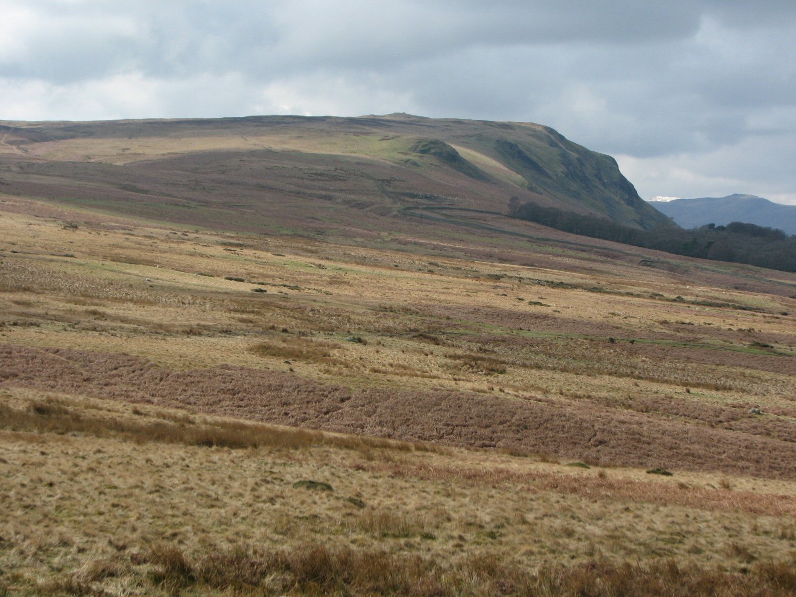
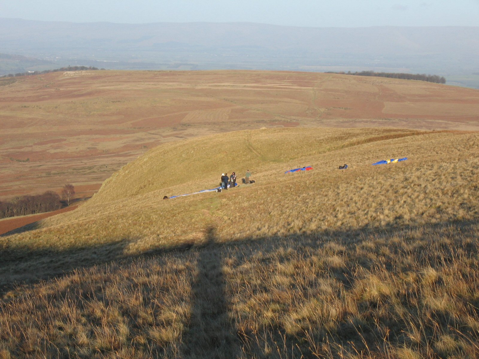
| Looking up to Barton Fell from the start of the access track. Take off is behind the large knoll 10 o'clock from the edge of the wood. |
 |
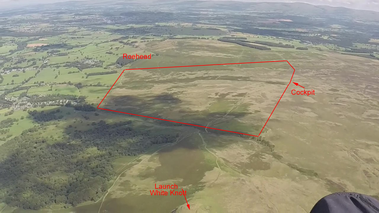
| NO FLYING AREA boundary. |
 |
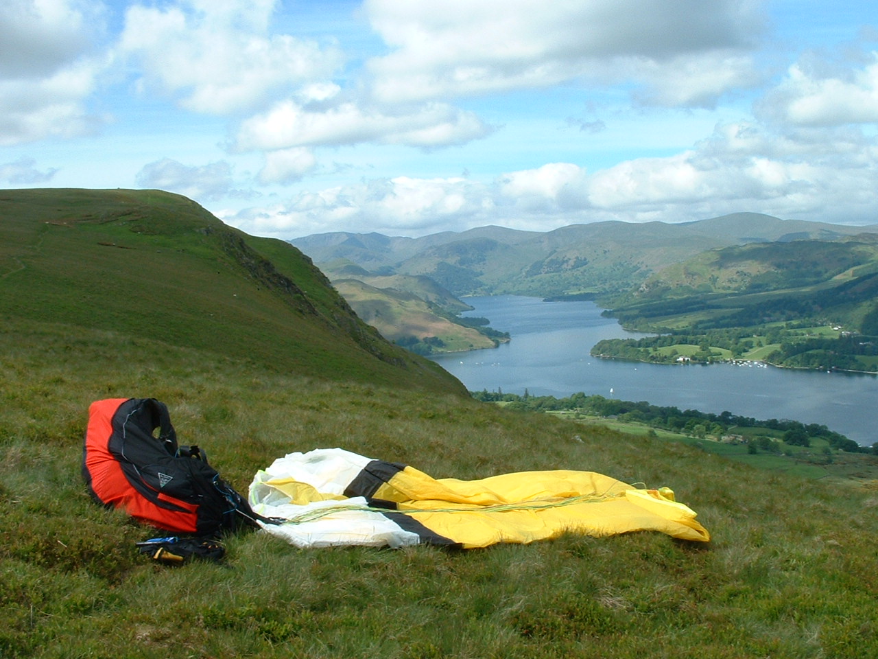
| Barton Fell on a glorious day looking up Ullswater, Helvellyn ridge in the background |
 |
| Takeoff on a cold, windy day in February 2007 looking NE. The wind died down as the sun sank allowing a short flight to be snatched. |
 |
| The Roe Head parking area at Barton does get very busy so an alternative area is to the east. You approach via Askham and Helton to a no through road going SW from Helton. The parking area is at grid reference NY 497 215 by a footpath fingerpost. |
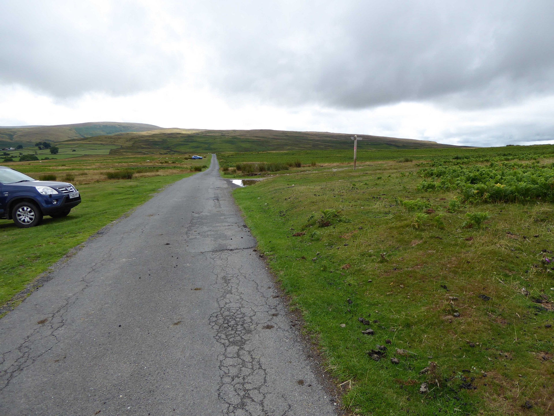 |
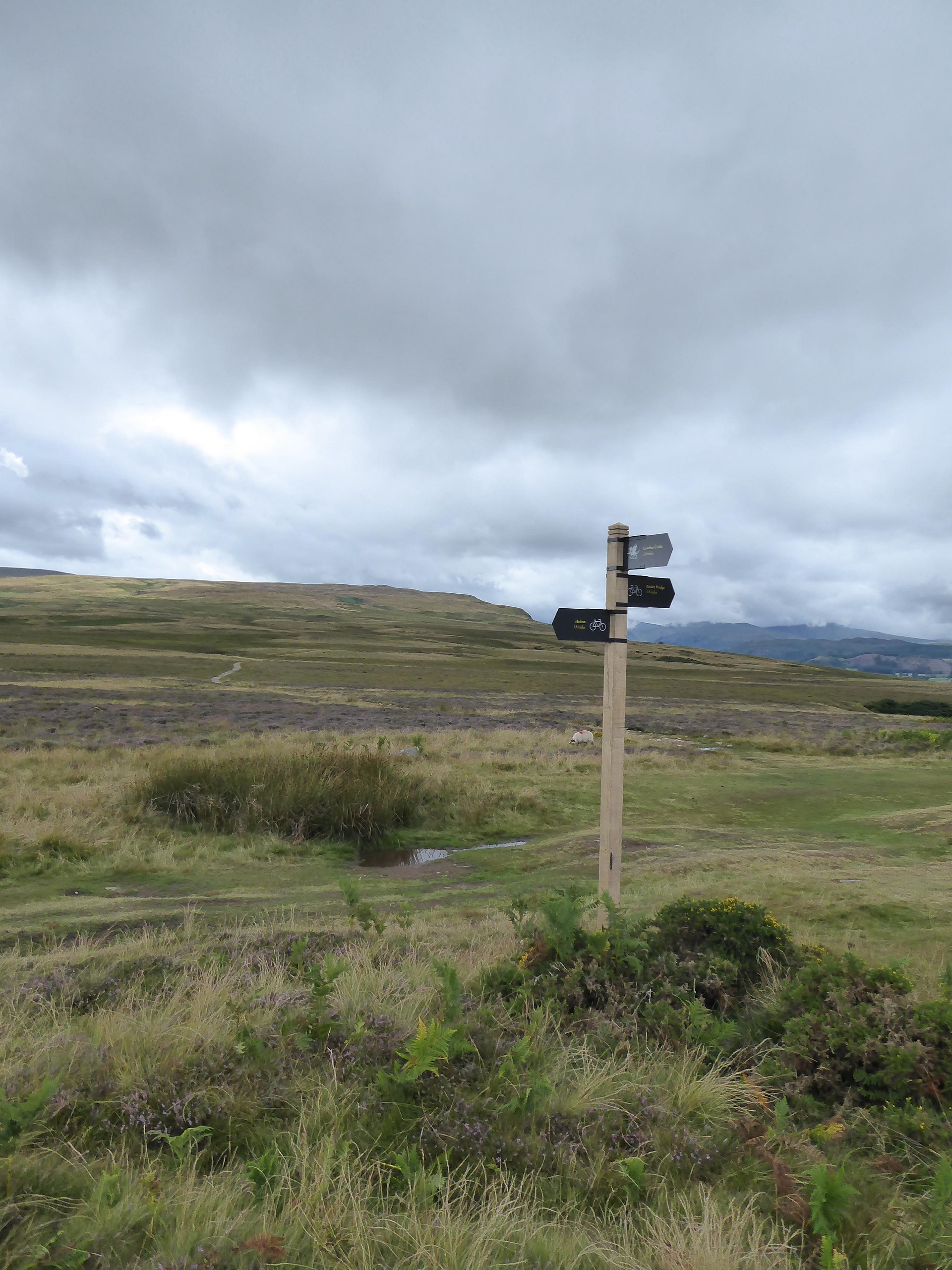
| From the fingerpost follow the track in a NW direction to another fingerpost at grid reference NY 487 225. Here turn left onto a WSW footpath that will take you to the normal route up to Barton Fell |
 |
Local Information - Pubs/Food etc
Nearest pubs to the site - for post flying debriefing only! You may find details of other facilities here
No pub details are available for this site. Send your recommendations to the webmaster.
This page shows records for this site. Some of the older records are not very detailed. More recent records may have an igc file available You can right click and download this to your PC. You can then use IGC Flight replay to view the flight.
| Paragliding |
| FAI Triangle | |
| Distance : | 18.6km |
| Date : | 16/04/2007 |
| Pilot : | Martin Sandwith |
| Notes : | Utilised the ridge of High Street with various attempts to push out forward |
| Open Distance XC | |
| Distance : | 94.7km |
| Date : | 22/04/2017 |
| Pilot : | Jaysen Metcalfe |
| Notes : | A four hour flight landing to the south of Addingham, to the west of Ilkley |
| IGC File : | Right click to download |
| Out and Return | |
| Distance : | 22.2km |
| Date : | 04/11/2014 |
| Pilot : | Mike Cavanagh |
| Notes : | |
| IGC File : | Right click to download |
| Turnpoint Flight | |
| Distance : | 99.8km |
| Date : | 22/04/2017 |
| Pilot : | Jaysen Metcalfe |
| Notes : | A four hour flight landing to the south of Addingham, to the west of Ilkley |
| IGC File : | Right click to download |
| Hang Gliding |
| FAI Triangle | |
| Distance : | 18.6km |
| Date : | 16/04/2007 |
| Pilot : | Martin Sandwith |
| Notes : | Utilised the ridge of High Street with various attempts to push out forward |
| Open Distance XC | |
| Distance : | 94.7km |
| Date : | 22/04/2017 |
| Pilot : | Jaysen Metcalfe |
| Notes : | A four hour flight landing to the south of Addingham, to the west of Ilkley |
| IGC File : | Right click to download |
| Out and Return | |
| Distance : | 22.2km |
| Date : | 04/11/2014 |
| Pilot : | Mike Cavanagh |
| Notes : | |
| IGC File : | Right click to download |
| Turnpoint Flight | |
| Distance : | 99.8km |
| Date : | 22/04/2017 |
| Pilot : | Jaysen Metcalfe |
| Notes : | A four hour flight landing to the south of Addingham, to the west of Ilkley |
| IGC File : | Right click to download |
Data Resources
Follow the links to see the site in Google Earth and Google Street view. To access the former, you will need to have Google Earth installed on your PC. You can also upload your flights to GE - use GPS Dump (Links Page) to convert a variety of GPS file formats to a GE kml file.
| Link | Resource Type | Notes |
|---|---|---|
| Google Earth - Car Park | ||
| Google Earth - Take Off | ||
| Google Street View - Parking | Try to park carefully. As you can see, the verges are suffering badly. The route to take off is by walking through the gate in front |
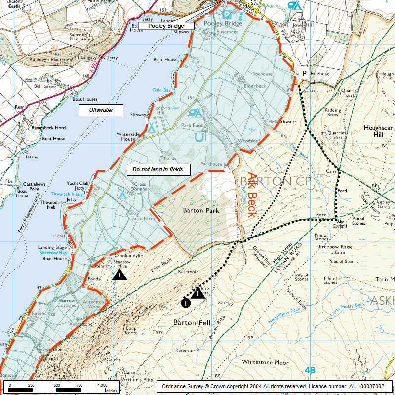
Barton Fell Map |
Legend |