WNW - WSW |
Black Combe (West) |
| Status : | OK | ||
| IMPORTANT - Restrictions on use | Avoid the south end of the site during the lambing season. Ask at the appropriate farm for permission | ||
| Last Updated : | 15/12/2021 at 19:15 by Ian Henderson | ||
| Wind : | WNW - WSW | ||
| Nil Wind : | No | ||
| Grid Ref : | SD119862 | Height (AMSL) : | 570' - 1500' / 174m - 458m |
| Site Code : | 17.055 | Top to Bottom : | 400' - 1330' / 122m - 406m |
Location
SW Lakes - nr Millom
Details
Generally smooth with extensive soaring. Being only 1500m inland the area is not renowned for its thermals. Either take off can be used depending on wind direction. The south end is the easier carry with an excellent top landing area. This is a safe and enjoyable place to fly for all pilots.
Local Sites Contact - Keith Paterson mobile 07841 056727
Site Officer
Keith Paterson :
Postcode for Sat Nav Systems (read the Health Warning!)
LA19 5UW - This is the closest mail delivery point to the flying site and is positioned at:
Monk Foss Farm about 1 mile south of the parking area.
Getting There
Overlooks east side of A595 (Whitehaven to Greenoddd road on the A590) south of Bootle. See map for parking areas. Only about 4 cars at both places; park as tight as possible. More car parking further up the road on the left.
Getting to takeoff
A footpath (signed) starts 1.6 km south of Bootle (limited parking). Follow footpath across field through two gates and onto open fell either straight up or road the back. Take off is just above a rocky outcrop
Permission to use site
Monk Foss Farm, Stangrah Farm; Townend Farm, Whitbeck; Hole Ghyll Farm; Parsonage Farm for the bottom landing field below the SE face; Far End Farm.
Additional Safety Notes
Beware of the pronounced horizontal component to the wind over the shallower upper slopes. Public telephones are at Valley End and Whitbeck.
Paragliding
No vices. Some interesting challenges exist; study the maps of the area. Either take off can be used depending upon whether wind is south or north of west. This is a great site for low airtime pilots as it often provides smooth and extensive lift.
Hang Gliding
As for PG but the north take off requires a bit of a carry and is more awkward to top land. Bottom landings are often done in fields through which a footpath runs. However, Monk Foss fields are the official ones. ask at Moss Foss.
XC potential
Great potential but only 36km for now
Videos
https://www.youtube.com/watch?v=GJHxTI_M3xI
Photos
Click on the photo for a full size image.
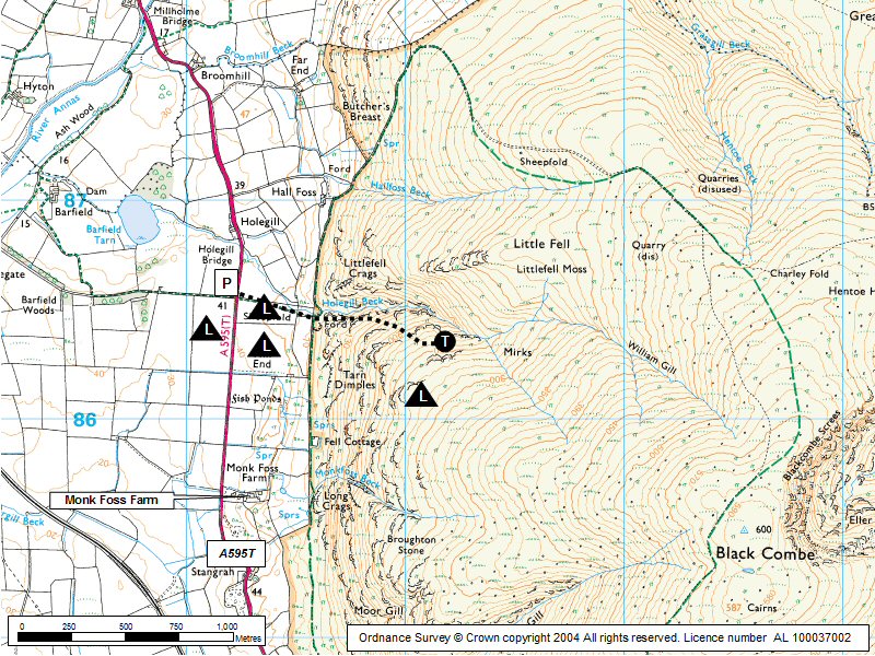
| Looking up to the take off area at Black Combe West. Photo by Mike Mason |
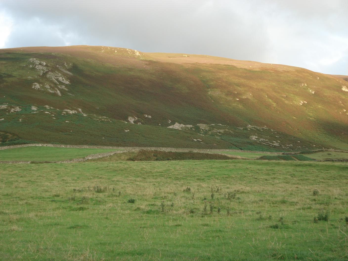 |
| Looking down to the landing fields from take off. The fields are to the left of the car both in front of and behind the car. Check which one is in use on the day. Photo by Mike Mason |
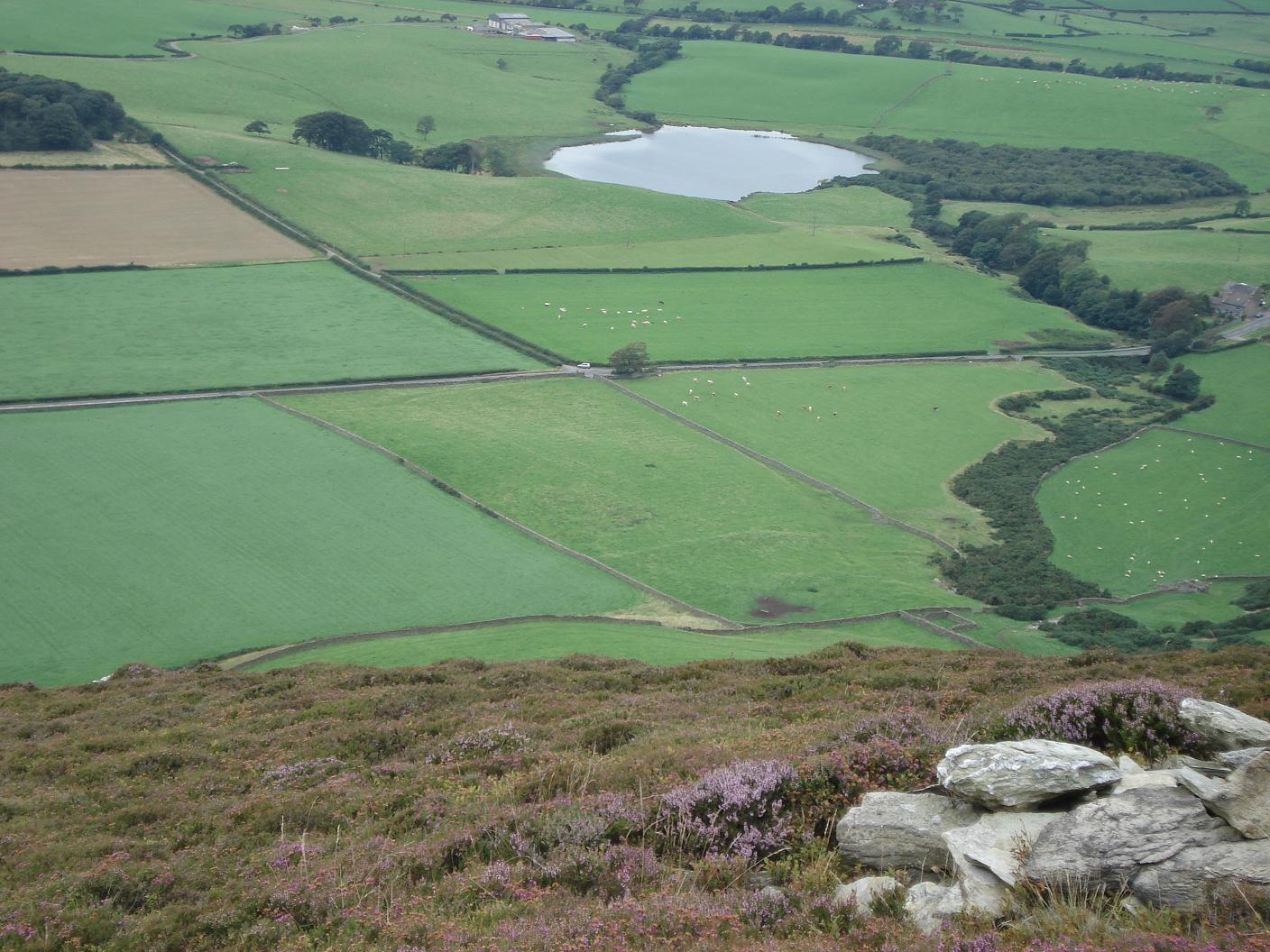 |
| From the landing field up to take off. Photo by Mike Mason |
 |
Local Information - Pubs/Food etc
Nearest pubs to the site - for post flying debriefing only! You may find details of other facilities here
| Miners Arms Silecroft | |
| Grid Reference : | SD131419 |
| Distance from Site : | 0.0 miles |
| Notes : | Great beer and Food garden |
| Click here to go to the web site | |
| Click here to see the place in Google Street View |
This page shows records for this site. Some of the older records are not very detailed. More recent records may have an igc file available You can right click and download this to your PC. You can then use IGC Flight replay to view the flight.
| Paragliding |
| Turnpoint Flight | |
| Distance : | 26.7km |
| Date : | 07/04/2017 |
| Pilot : | Jaysen Metcalfe |
| Notes : | Black Combe north to Devoke Water and then east to a landing directly in front of the Newfield Inn, Seathwaite in the Duddon Valley |
| IGC File : | Right click to download |
| Hang Gliding |
| Turnpoint Flight | |
| Distance : | 26.7km |
| Date : | 07/04/2017 |
| Pilot : | Jaysen Metcalfe |
| Notes : | Black Combe north to Devoke Water and then east to a landing directly in front of the Newfield Inn, Seathwaite in the Duddon Valley |
| IGC File : | Right click to download |
Data Resources
Follow the links to see the site in Google Earth and Google Street view. To access the former, you will need to have Google Earth installed on your PC. You can also upload your flights to GE - use GPS Dump (Links Page) to convert a variety of GPS file formats to a GE kml file.
| Link | Resource Type | Notes |
|---|---|---|
| Google Earth - Car Park | ||
| Google Earth - Take Off | Jaysen Metcalfe's take off point for his flight to the Duddon valley on 7 April 2017 | |
| Google Street View - Parking | This is the limited parking area on the side of the A595. Make sure you don't block the entrances |
Black Combe (West) Map |
Legend |