NNE - ENE |
West Fell / Sandbeds |
| Status : | OK | ||
| IMPORTANT - Restrictions on use | - STAY WELL AWAY FROM & DON'T OVERFLY HORSES or PONY-TREKKERS. If possible please contact local pilot Jonny Sims (07792 460123 [email protected]) who will liaise with pony trekkers if possible. - TO LIMIT THE DISTURBANCE OF GROUND NESTING BIRDS. From the 01st March through to 31st July: Stay on the tracks/paths, limit wandering about and watch where you put your feet NO GROUND-HANDLING sessions please. - DO NOT DRIVE UP ANY OF THE TRACKS. Please park at Calebreck (NY 345 358) and walk up the track to the old mine workings and then to the chosen take off area. The Park Authority are monitoring this and will take action act against offenders. - AVOID DISTURBING LIVESTOCK. Be aware farmers are concerned that we may push sheep off the fell. For the WHOLE of MAY & JUNE, the site will be CLOSED for HEFTING new sheep. - NO DOGS loose on the site. - COMPETITIONS. Comps or other events must not be based at, or run from, this site without an LDNPA licence. |
||
| Last Updated : | 15/10/2025 at 15:01 by Rick Livingstone | ||
| Last Reviewed : | 01/05/2022 by | ||
| Wind : | NNE - ENE | ||
| Nil Wind : | No | ||
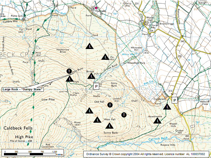
| Grid Ref : | NY326364 | Height (AMSL) : | 1500' / 458m |
| Site Code : | 17.071 | Top to Bottom : | 200' / 61m |
Location
NE Lakes - NE of Blencathra
Details
A small but useful site. It has only a short beat but with 400' / 122m ato it is possible to fly to the NNE faces of West Fell and Carrock Fell. In reasonable NE conditions all three sites are fairly easily inter-flown.
Site Officer
Rick Livingstone : 07761187016
Postcode for Sat Nav Systems (read the Health Warning!)
CA7 8JR - This is the closest mail delivery point to the flying site and is positioned at:
Calebreck. This building is immediately adjacent to the parking area.
Getting There
If travelling from the main A66(T) then follow the directions for getting to Carrock Fell via Mungrisedale. Continue northwards past Carrock Fell, keep left at the Carrock Fell Site car parking, cross a small ford soon after. Continue to the start of the track at Calebreck (NY 345 358) where you should park (see restrictions re vehicle use).
Getting to takeoff
Walk up the approach track from Calebreck (NY 345 358). Follow the track up onto the fellside until it reaches a wide area of old mine workings. The take offs can then be reached by contouring (and ascending a little) onto the open fellside.
Permission to use site
Currently under negotiation.
Hazards
The top landing and bottom landing areas have some hidden (and some not so hidden) boulders. Exercise caution.
Take Off
Landing Areas
Some rocks !
Flying
Easy slope to fly with large top and bottom landing areas
XC potential
If the site can be linked with Carrock Fell then the downwind XC potential is very good with the coast lying approx 45 km away. In the right conditions the area out in front of the site can be explored for some interesting triangles and out and returns.
Photos
Click on the photo for a full size image.
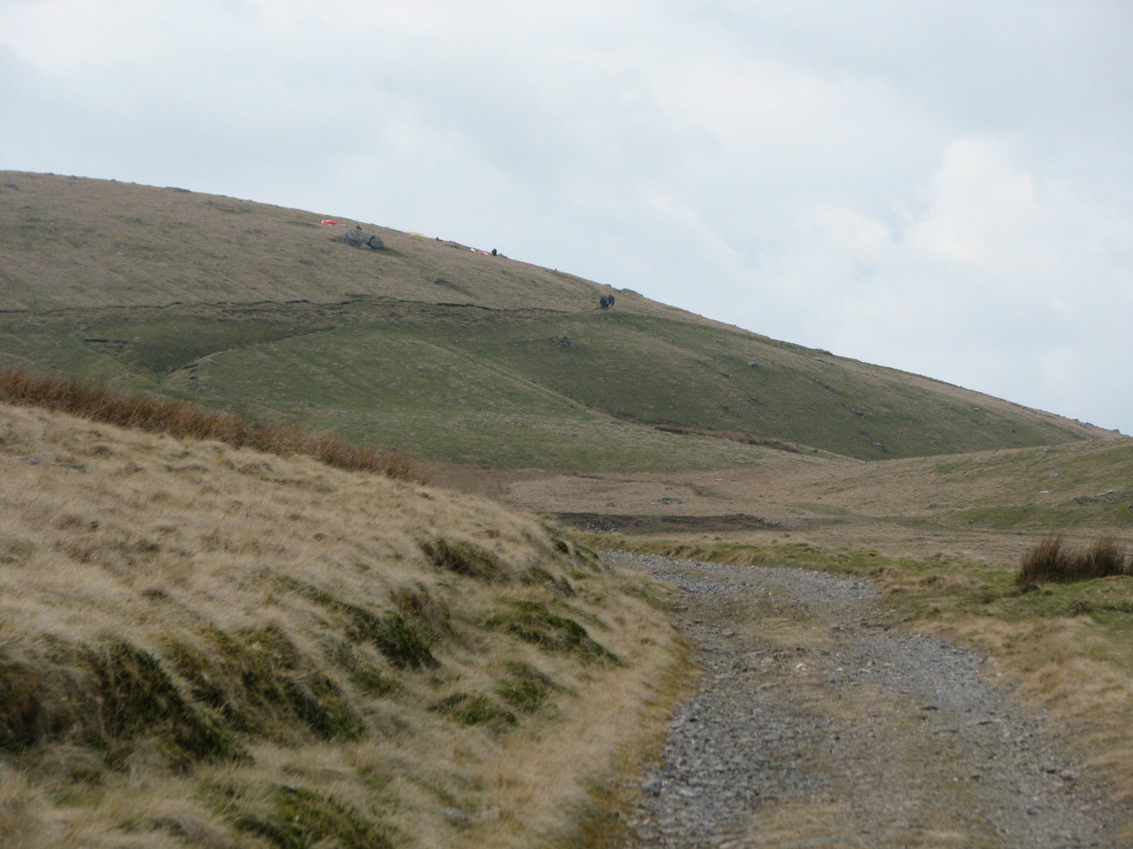
| A not very good picture taken from the access road looking up to take off on West Fell. If you have a better one, then let me have a copy. |
 |
Local Information - Pubs/Food etc
Nearest pubs to the site - for post flying debriefing only! You may find details of other facilities here
No pub details are available for this site. Send your recommendations to the webmaster.
This page shows records for this site. Some of the older records are not very detailed. More recent records may have an igc file available You can right click and download this to your PC. You can then use IGC Flight replay to view the flight.
| Paragliding |
| Open Distance XC | |
| Distance : | 70.7km |
| Max Height : | 6308ft |
| Date : | 10/05/2005 |
| Pilot : | Burkitt Rudd |
| Notes : | Take off : 12:30 Flight Duration: 3 hrs 40 mins Landing: Walney Island Max speed: 69.47 km/h Mean speed: 35.3 km/h Max alt (ASL) 1923m (6308ft ) Max vario: 13.0m/s (2558 ft/min) Min vario: -11.0 m/s (-2165 ft/min) Altitude gain: 1493m (4898 ft) Glider: Gradient Bliss 28 |
| Hang Gliding |
No hang gliding records available for this site
Data Resources
Follow the links to see the site in Google Earth and Google Street view. To access the former, you will need to have Google Earth installed on your PC. You can also upload your flights to GE - use GPS Dump (Links Page) to convert a variety of GPS file formats to a GE kml file.
| Link | Resource Type | Notes |
|---|---|---|
| Google Earth - Car Park | ||
| Google Street View - Parking | The parking area at West Fell |
West Fell / Sandbeds Map |
Legend |